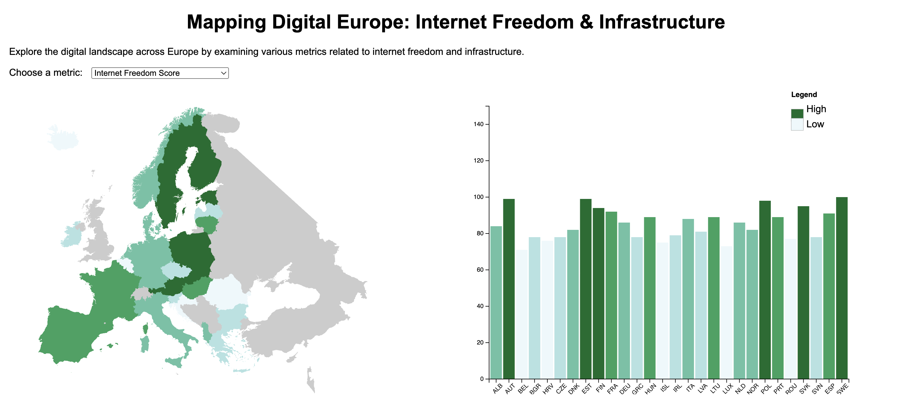
Mapping Digital Europe
Coordinated choropleth and bar chart (D3) exploring internet access and freedom metrics.
View projectSelected geospatial, cartographic, and analytics projects.
Coordinated choropleth and bar chart (D3) exploring internet access and freedom metrics.
View project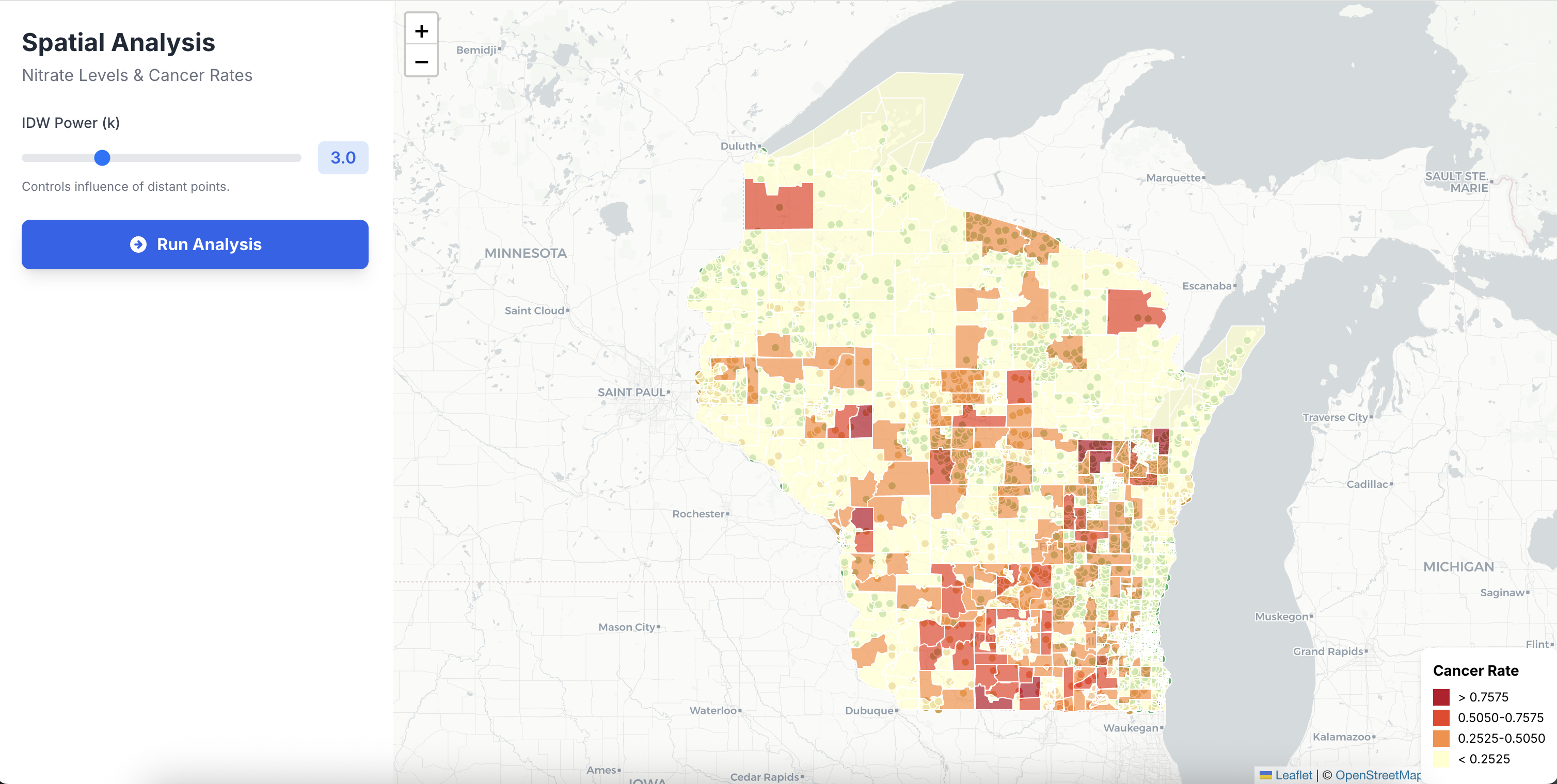
Leaflet app with client-side interpolation and regression for exploratory health analysis.
View project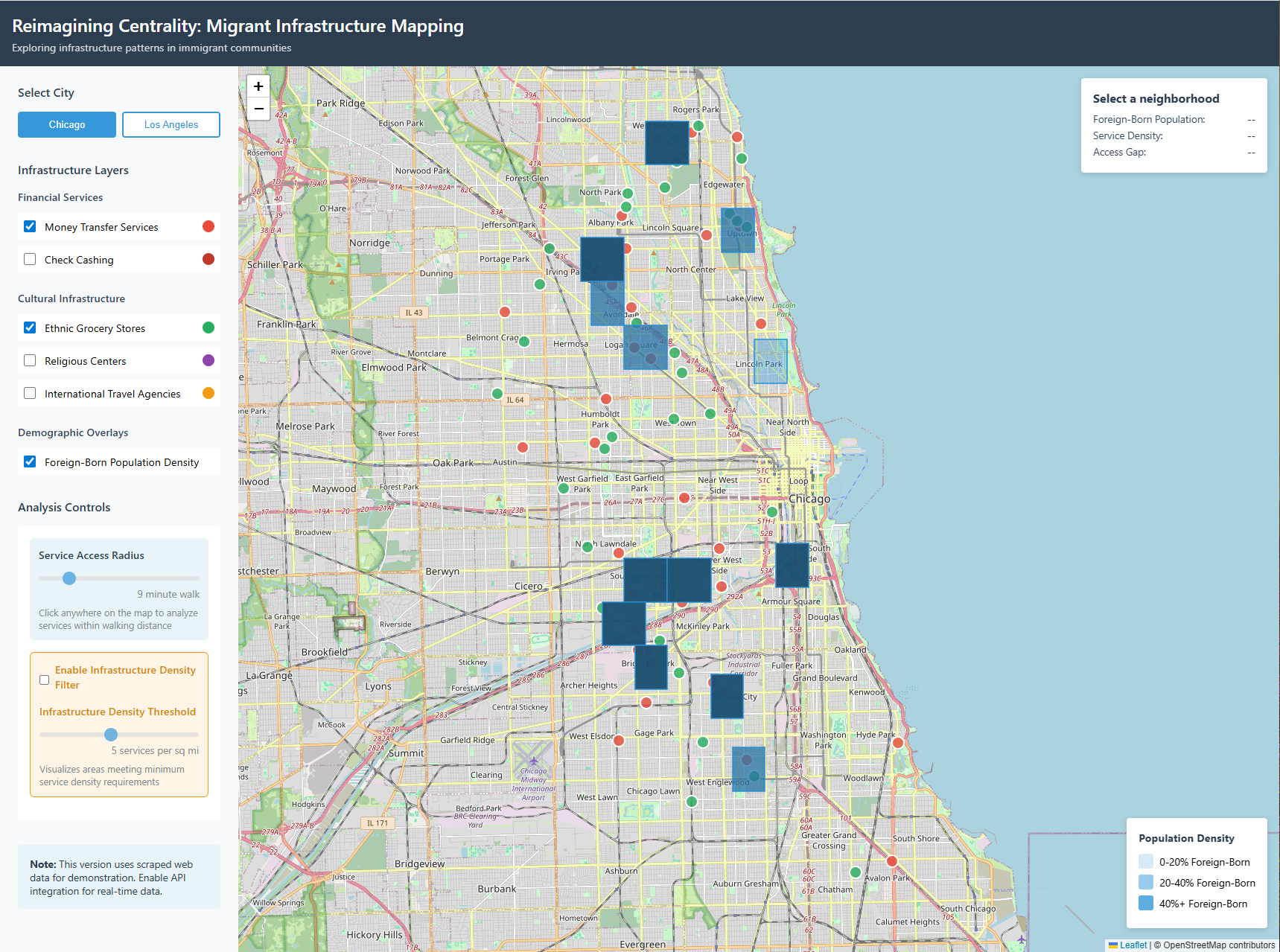
Prototype mapping migrant-serving amenities using Central Place Theory as an analytical frame.
View project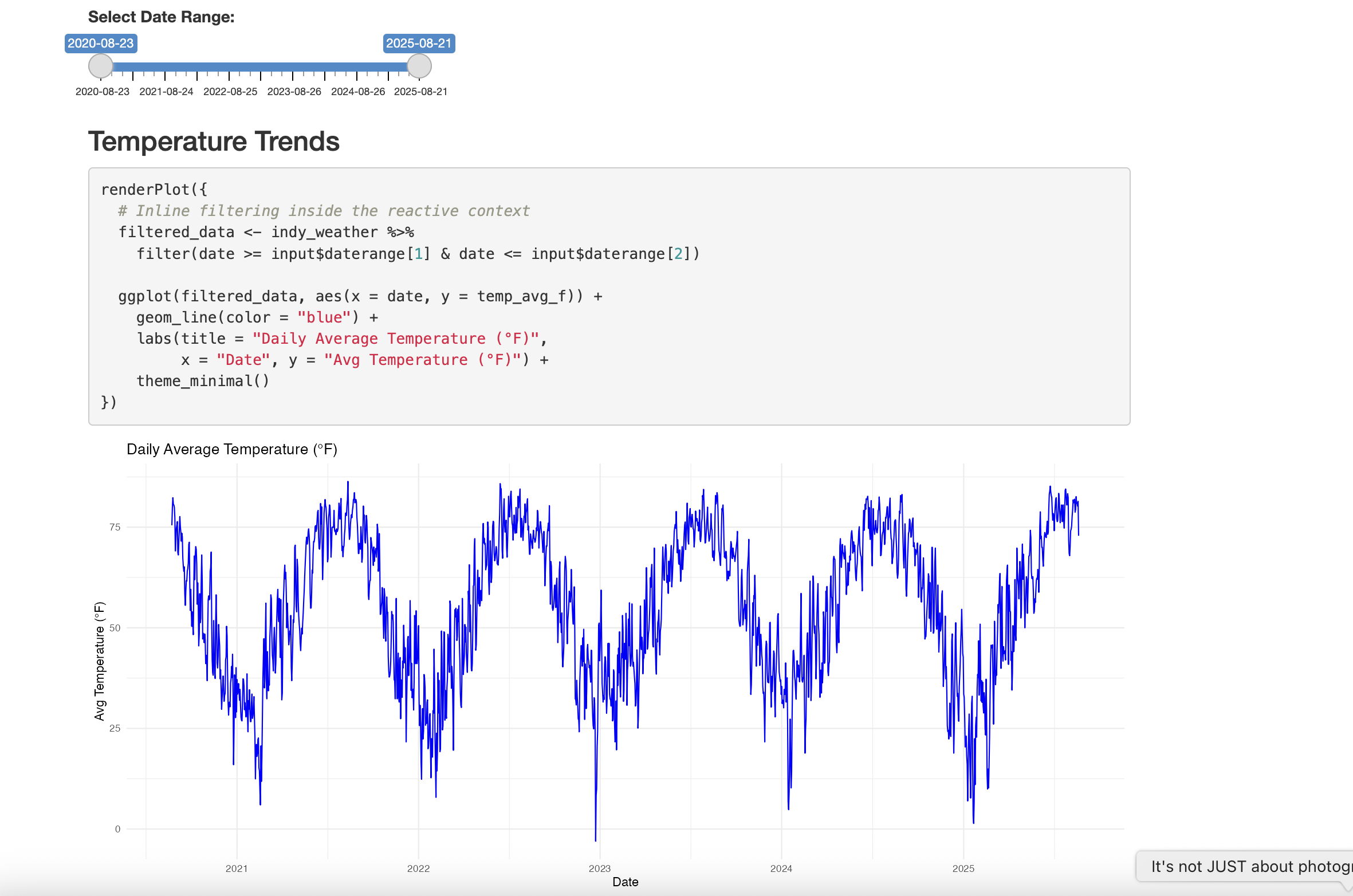
R + Quarto dashboard analyzing temperature and precipitation patterns in Indianapolis.
View project